About All Tours From Darwin ToursScenic Flight ToursYellow Water Cruise Tours Directions Hours & Fees Guides
Find Tours 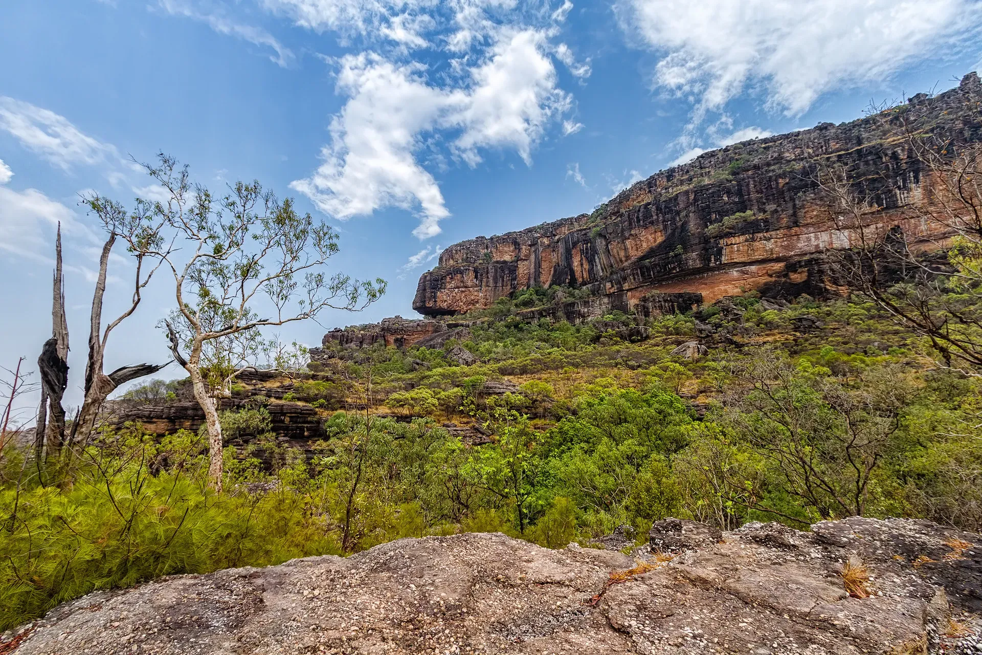
Kakadu National Park is a 20,000-square-kilometre protected wilderness in Australia's Northern Territory, located 250 kilometres southeast of Darwin. It holds dual UNESCO World Heritage status for its 65,000-year Aboriginal history and vast floodplain ecosystems.
Kakadu National Park covers 20,000 square kilometres of the Northern Territory. At about half the size of Switzerland, the reserve sits 250 kilometres southeast of Darwin in the Alligator Rivers Region. It encompasses mangrove estuaries and savanna woodlands. Along the eastern boundary, the Arnhem Land escarpment rises up to 300 metres. Visitors drive three hours from the capital to reach this vast wilderness, where ancient human history intersects with floodplains that disappear entirely during the monsoon.
Parks Australia and Aboriginal Traditional Owners manage the land jointly. More than half the park remains Aboriginal freehold land, governed by a board with an Indigenous majority. People come to see ancient rock art and towering waterfalls. Wildlife is abundant. Ten thousand saltwater crocodiles live in the rivers. Up on the floodplains, 280 bird species—roughly a third of Australia's total—build their nests. The Mamukala Wetlands bird hide offers clear views of tens of thousands of magpie geese gathering in the late dry season.
Most people visit during the dry season between May and October. Water levels drop and animals concentrate around shrinking waterholes. When the tropical summer arrives, it brings up to 1.5 metres of rain. Floodwaters cover a third of the park. This cuts off access to major sites like Jim Jim Falls. You'll need a 7-day park pass to enter. It costs $40 for adults in the dry season and drops to $25 when the rains arrive. Family passes cost $100. Northern Territory residents enter free with proof of residency, and Australian school groups are exempt from fees entirely.
Public transport does not run here. You must drive yourself or join a tour from Darwin. Most visitors spend at least three days exploring the main sites. A thorough trip covering the remote southern gorges takes five days. You'll need a 4WD to access many of the best waterfalls. Near Jabiru, the Bowali Visitor Centre provides the best starting point. It operates from 9 am to 5 pm in the dry season. The architecture mimics an Aboriginal rock shelter. Inside, detailed exhibits explain the local ecosystems and seasonal changes. Staff post daily updates on road closures and crocodile sightings.
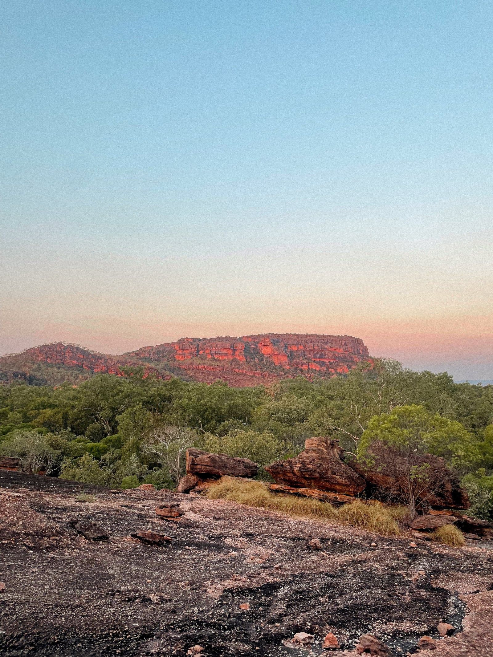
Aboriginal people have lived in the Kakadu region for more than 65,000 years. They belong to the oldest continuously living culture on Earth. Across the stone country and floodplains, thousands of rock art sites document this history. At Ubirr and Burrungkuy, paintings date back 20,000 years. These galleries show extinct animals and daily life. The paint is ochre. Later additions at Nanguluwurr show European tall ships. They record the first contact with outsiders. The art provides a continuous visual history of human occupation through massive environmental shifts, including the rising sea levels at the end of the last ice age. Archaeologists have excavated stone tools at Madjedbebe, a rock shelter surrounded by the park, confirming human presence here long before megafauna went extinct.
European explorers arrived in the late 19th century. Ludwig Leichhardt crossed the region in 1845 during his expedition from Queensland to Port Essington. Pastoralists followed, attempting to raise cattle on the floodplains. The environment proved hostile. Buffalo hunters arrived next, targeting the feral water buffalo introduced to northern settlements decades earlier. These industries disrupted traditional Aboriginal land management and introduced invasive species. Decades later, mining companies discovered significant uranium deposits in the Alligator Rivers Region. The Ranger Uranium Mine began operations in 1980. It sits completely surrounded by the park but remains legally separate from it. The mine ceased operations in 2021 and is currently undergoing extensive rehabilitation to return the land to a state suitable for incorporation into the national park. The town of Jabiru was built specifically to house the mine workers. It is now transitioning into a tourism hub owned by the Mirarr Traditional Owners.
The Australian government declared Kakadu a national park in three stages between 1979 and 1991. The name comes from "Gagudju", an Aboriginal language spoken in the northern part of the park at the time of European settlement. UNESCO added the park to the World Heritage List in 1981. Subsequent extensions in 1987 and 1992 expanded the protected area. In 2011, Traditional Owners requested the inclusion of the Koongarra area. The government agreed. This added another cultural site to the boundary and protected it from future mining claims.
Today, Kakadu operates under a joint management model. Traditional Owners hold the deeds to more than half the land. They lease it back to the Director of National Parks. A Board of Management makes the operational decisions. This structure ensures cultural protocols dictate how the land is used. Certain areas remain strictly off-limits to visitors for ceremonial reasons. You won't find signs explaining exactly what happens there—the privacy is intentional. Rangers conduct controlled burns early in the dry season. This mimics traditional fire management practices and prevents destructive late-season wildfires. Near Cooinda, the Warradjan Aboriginal Cultural Centre explains these management techniques through artifacts and personal histories. The building's circular design represents a warradjan, the pig-nosed turtle.
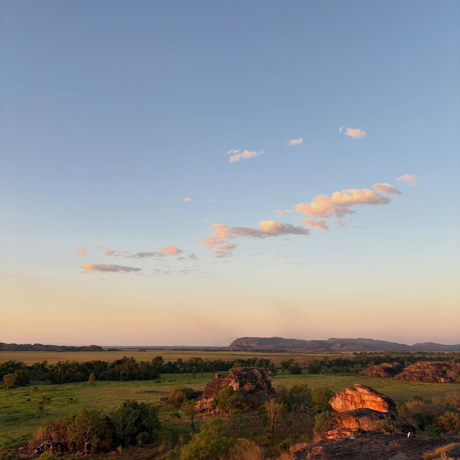
Savanna woodlands cover 80 percent of Kakadu. These dry, open forests stretch across the lowlands and support endemic plants like the Darwin woollybutt. To the north, the landscape shifts into mangrove estuaries along the Van Diemen Gulf. The tidal flats host mudskippers and fiddler crabs. The coastal areas act as a buffer against cyclones moving inland from the Timor Sea.
The Arnhem Land escarpment dominates the eastern edge. This sandstone plateau formed 140 million years ago from ancient sea cliffs. It rises between 30 and 300 metres above the plains. The rock face continues to erode by about one metre every thousand years. Deep gorges cut through the stone country. They funnel wet-season rains into massive plunge pools. Jim Jim Falls drops 200 metres down these vertical cliffs into a shaded amphitheatre (the water is freezing, even in summer). That's the one to photograph. Twin Falls cascades onto a white sand beach flanked by monsoon rainforest. Reaching it requires a high-clearance 4WD vehicle and a short boat shuttle across the gorge.
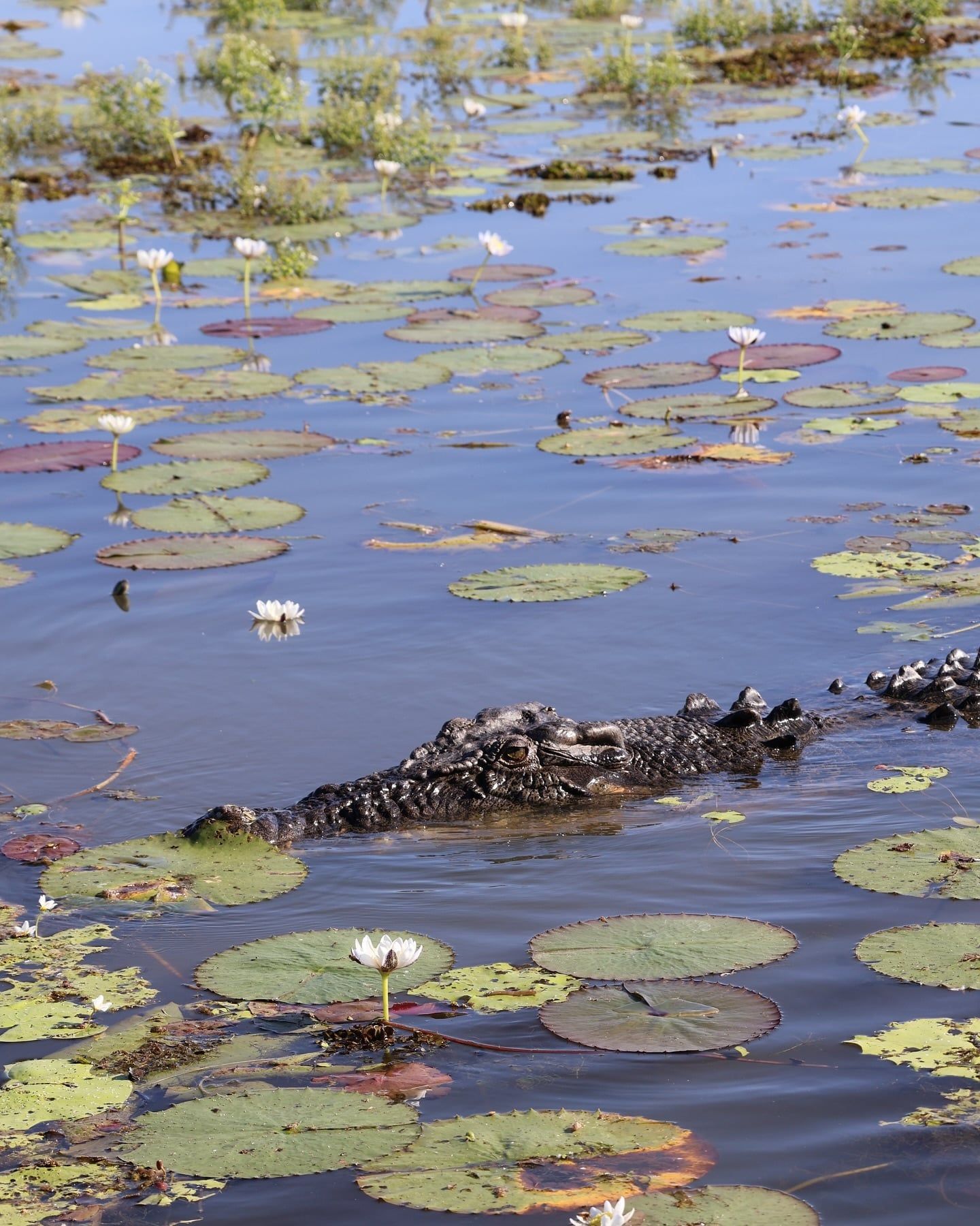
During the tropical summer, the South and East Alligator rivers burst their banks. Floodwaters spread across the plains to create vast wetlands. Yellow Water Billabong is the most famous permanent waterhole here. It supports dense populations of saltwater crocodiles. Up to seven crocodiles often gather at Cahills Crossing during tidal surges to feed on barramundi. As the dry season progresses, the water recedes. The floodplains bake into cracked mud flats. This forces wildlife back to the permanent rivers.
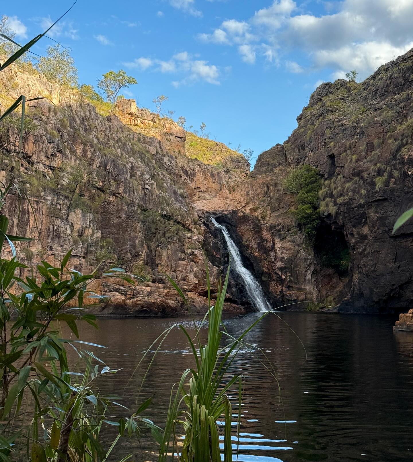
The southern section of the park features the Stone Country. Gunlom Falls sits here. It has an upper infinity plunge pool with sweeping views over the plains below. The walk up is steep. The lower picnic area provides an easier alternative for families. Maguk, another southern gorge, requires a short hike through a paperbark forest to reach a deep, clear swimming hole surrounded by steep canyon walls. The flora is highly adapted to the extreme climate. Two thousand plant species grow within the park boundaries. Water lilies choke the billabongs during the wet season. Kapok trees drop their leaves and produce bright yellow flowers during the dry season. This signals to local Aboriginal people that the freshwater crocodiles are laying their eggs.
Kakadu is one of only a few dozen sites worldwide holding dual UNESCO World Heritage status for both natural and cultural values. The landscape maps the journeys of creation ancestors. According to Bininj and Mungguy traditions, these beings shaped the rocks and rivers during the creation era. Namarrgon, the Lightning Man, is painted at the Anbangbang Gallery. He controls the violent lightning storms that strike the escarpment during the tropical summer build-up.
Rock art is a historical record. Elders use the paintings at Ubirr to teach younger generations about hunting and social laws. The art features X-ray styles revealing the internal organs of fish. Some panels show extinct thylacines. The sites are active classrooms. The Nadab floodplain stretches out below Ubirr, providing a physical context for the stories painted on the rocks above.
Traditional Owners continue to hunt and conduct ceremonies on their country. Visitors must observe strict cultural protocols. Alcohol is banned at Ubirr. Certain burial grounds remain permanently closed to the public. Traditional Owners manage the land actively.
Language remains active across the park. Bininj Kunwok is the main language group in the north, while Jawoyn is spoken in the south. The seasonal calendar drives all activity. Bininj and Mungguy recognize six distinct seasons based on weather patterns and plant cycles. Yegge, from May to June, signals the time to start patch-burning the woodlands. Gudjewg, the monsoon season from January to March, brings violent thunderstorms and explosive plant growth. Banggerreng, in April, features heavy storms that flatten the tall speargrass. Wurrgeng, the early dry season from June to August, brings cooler weather and shrinking creeks. Gurrung, the hot dry season from August to October, forces animals to congregate around the remaining permanent waterholes. Gunumeleng, the pre-monsoon build-up from October to December, brings intense humidity and the first afternoon showers. This calendar dictates exactly when to hunt specific animals and harvest specific plants.
Kakadu is one of only four sites in Australia recognized by UNESCO for both its natural environment and cultural history.
More than 10,000 saltwater crocodiles live in the park, representing about a tenth of the entire Northern Territory population.
The park hosts 280 bird species. That accounts for roughly one-third of all bird species found in Australia.
The 140-million-year-old Arnhem Land escarpment continues to erode backward at a rate of one metre every thousand years.
The Nanguluwurr rock art gallery features paintings of European tall ships, documenting the Aboriginal perspective of early contact.
The upper plunge pool at Gunlom Falls served as a major filming location for the 1986 movie Crocodile Dundee.
During the tropical summer, up to 1.5 metres of rain falls on the park, submerging a third of the entire 20,000-square-kilometre reserve.
A 7-day pass costs $40 for adults during the dry season and $25 during the tropical summer. Family passes are $100 in the dry season. Northern Territory residents enter free with proof of residency.
You must drive yourself or join a guided tour. The park sits 250 kilometres southeast of Darwin via the Stuart and Arnhem highways. The drive takes about three hours on sealed roads.
Swimming is dangerous in most waterways due to saltwater crocodiles. You should only swim at officially designated safe sites like the upper pools at Gunlom or Maguk. Always obey crocodile warning signs.
The dry season from May to October is the most reliable time to visit. Roads open, temperatures drop, and waterfalls like Jim Jim and Twin Falls become accessible. The wet season floods a third of the park and closes many major sites.
The park covers 20,000 square kilometres. It extends nearly 200 kilometres from north to south and over 100 kilometres from east to west. That makes it roughly half the size of Switzerland.
The oldest paintings at sites like Ubirr and Burrungkuy date back 20,000 years. The galleries also feature recent additions, including paintings of European tall ships at Nanguluwurr.
All visitors from outside the Northern Territory need a standard park pass. You will need additional special permits for off-track bushwalking, overnight camping outside designated areas, or visiting restricted sites like Koolpin Gorge.
No. Drones are strictly prohibited without a commercial permit. Parks Australia does not issue recreational drone permits under any circumstances.
More than 10,000 saltwater crocodiles inhabit the park. They live in floodplains, billabongs, creeks, and coastal areas. You can easily spot them at Yellow Water Billabong and Cahills Crossing.
Two to three days is enough to see the main highlights like Ubirr and Yellow Water. If you want to drive the 4WD tracks to Jim Jim Falls and the southern gorges, plan for four to five days.
Browse verified tours with free cancellation and instant confirmation.
Find Tours